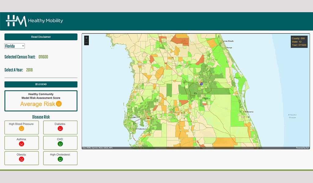
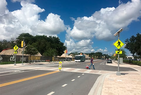
Keeping communities healthy requires careful planning and comprehensive data and has never been more important. When considering planning and design enhancements, it is imperative to first understand how these initiatives will make it easier for people to live healthier lives. However, data—and analytics to help understand the impacts of the built and social environment on public health has been extremely limited.
VHB’s innovative Healthy Mobility Model closes the gap where health data is not readily available. Utilizing GIS mapping powered by ESRI, the Healthy Mobility Model establishes a baseline health risk assessment within a designated area by correlating census and published health data with land use, urban design, and mobility data. This assessment, or community health profile, eliminates intensive and time-consuming surveying while identifying and prioritizing improvements.
With the Healthy Mobility Model, municipalities can easily distinguish alternative scenarios and identify factors with the strongest relationships to building better health outcomes while tracking improvements over time. Our quantitative results within a given profile help decision-makers think more holistically and support sustainable solutions that consider social, environmental, and economic impacts.